PDS logoPlanetary Data System
PDS Information
Find a Node - Use these links to navigate to any of the 8 publicly accessible PDS Nodes.

This bar indicates that you are within the PDS enterprise which includes 6 science discipline nodes and 2 support nodes which are overseen by the Project Management Office at NASA's Goddard Space Flight Center (GSFC). Each node is led by an expert in the subject discipline, supported by an advisory group of other practitioners of that discipline, and subject to selection and approval under a regular NASA Research Announcement.
Click here to return to the Photojournal Home Page Click here to view a list of Photojournal Image Galleries Photojournal_inner_header
Latest Images  |  Spacecraft & Technology  |  Animations  |  Space Images App  |  Feedback  |  Photojournal Search  
Your search criteria found 8 images
Feature Name
Go to PIAxxxxx:
Refine this list of images by:
Mission:
Spacecraft:
Instrument:
Click on an image for detailed information
Click on a column heading to sort in ascending or descending order
My
List
Addition DateSort Ascending Target Mission Instrument Size
Add Image to Favorite List 2019-08-08 Earth ECOSTRESS
974x864x3
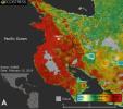
This ECOSTRESS image shows plant stress in the Guanacaste region of Costa Rica a few months after the onset of a major Central American drought.
PIA22839:
ECOSTRESS Focuses on Costa Rican Drought
Full Resolution:     TIFF (1.922 MB)     JPEG (129.8 kB)
Add Image to Favorite List 2015-04-06 Earth Terra
ASTER
1255x897x3
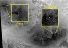
The March, 2015 eruption of Turrialba Volcano in Costa Rica caught everyone by surprise as seen in this image from the ASTER instrument onboard NASA's Terra spacecraft.
PIA19355:
Costa Rica's Turrialba Volcano, Continued Activity seen by NASA Spacecraft
Full Resolution:     TIFF (3.379 MB)     JPEG (167.9 kB)
Add Image to Favorite List 2011-11-02 Earth Terra
MISR
864x812x3
This image was acquired by the Multi-angle Imaging SpectroRadiometer instrument aboard NASA's Terra spacecraft. This image is from the MISR Where on Earth...? Mystery Quiz #26.
PIA15016:
Where on Earth...? MISR Mystery Image Quiz #26: Costa Rica
Full Resolution:     TIFF (2.107 MB)     JPEG (164.7 kB)
Add Image to Favorite List 2002-10-25 Earth Landsat
Shuttle Radar Topography Mission (SRTM)
C-Band Interferometric Radar
Thematic Mapper
1152x870x3
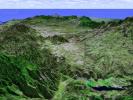
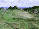
This perspective view taken in February 2000 from NASA's Landsat and Shuttle Radar Topography Mission shows the capital city of San Jose, Costa Rica, the gray area in the center of the image.
PIA03367:
Perspective View with Landsat Overlay, San Jose, Costa Rica
Full Resolution:     TIFF (3.01 MB)     JPEG (210.8 kB)
Add Image to Favorite List 2002-10-25 Earth Landsat
Shuttle Radar Topography Mission (SRTM)
C-Band Interferometric Radar
Thematic Mapper
1152x870x3
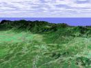
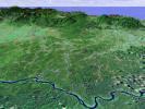
This perspective view taken in February 2000 from NASA's Landsat and Shuttle Radar Topography Mission shows the Caribbean coastal plain of Costa Rica, with the Cordillera Central rising in the background.
PIA03366:
Perspective View with Landsat Overlay, Costa Rica
Full Resolution:     TIFF (3.01 MB)     JPEG (220.9 kB)
Add Image to Favorite List 2002-10-22 Earth Shuttle Radar Topography Mission (SRTM)
C-Band Interferometric Radar
9600x9000x3
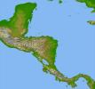
Panama, Costa Rica, Nicaragua, El Salvador, Honduras, Guatemala, Belize, southern Mexico and parts of Cuba and Jamaica are all seen in this image from NASA's Shuttle Radar Topography Mission.
PIA03364:
Colored Height and Shaded Relief, Central America
Full Resolution:     TIFF (84.57 MB)     JPEG (8.603 MB)
Add Image to Favorite List 2001-07-19 Earth Landsat
Shuttle Radar Topography Mission (SRTM)
C-Band Interferometric Radar
Thematic Mapper
1152x870x3
This perspective view from NASA's Shuttle Radar Topography Mission shows the capital city of San Jose, Costa Rica, in the right center of the image (gray area).
PIA03316:
SRTM Perspective View with Landsat Overlay: San Jose, Costa Rica
Full Resolution:     TIFF (3.206 MB)     JPEG (201.4 kB)
Add Image to Favorite List 2001-07-19 Earth Landsat
Shuttle Radar Topography Mission (SRTM)
C-Band Interferometric Radar
Thematic Mapper
1152x870x3
This perspective view from NASA's Shuttle Radar Topography Mission shows the northern coastal plain of Costa Rica with the Cordillera Central, composed of a number of active and dormant volcanoes, rising in the background.
PIA03315:
SRTM Perspective View with Landsat Overlay: Costa Rica Coastal Plain
Full Resolution:     TIFF (3.482 MB)     JPEG (244.9 kB)
Currently displaying images: 1 - 8 of 8